


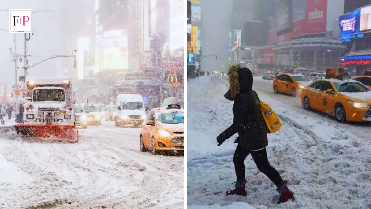
What Is a Snow Bomb? (Quick Answer)
A snow bomb is the common nickname for a bomb cyclone — a winter storm that intensifies explosively when its central air pressure drops at least 24 millibars in 24 hours. That rapid drop, called bombogenesis, can turn an ordinary storm into one with blizzard-force snow, hurricane-strength winds, and widespread power outages within a single day.
Every winter, meteorologists start throwing around a dramatic-sounding term: snow bomb. It sounds like something out of a disaster movie, but it’s a real and increasingly common weather event. Therefore, understanding what it actually means can help you plan ahead instead of getting caught off guard.
A snow bomb forms when a storm’s pressure collapses so quickly that it “bombs out” into a much stronger system almost overnight. As a result, cities can go from light flurries to a full-blown blizzard in a matter of hours. This guide breaks down exactly how that happens, shows real examples from recent winters, and walks through how to stay safe when one is headed your way.
What Is a Snow Bomb, Exactly?
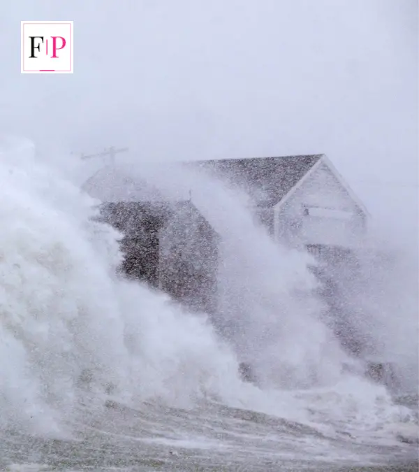
“Snow bomb” isn’t an official meteorological term — it’s a media-friendly nickname for what scientists call a bomb cyclone, and the process itself is called bombogenesis. However, the two terms describe the same thing: a storm that strengthens explosively and produces heavy snow.
According to NOAA’s National Ocean Service, bombogenesis happens when a mid-latitude cyclone’s central pressure falls by at least 24 millibars in 24 hours at 60 degrees latitude. Closer to New York City’s latitude, that threshold drops to about 17.8 millibars in the same window. A millibar is simply the unit meteorologists use to measure atmospheric pressure — the lower the number, the more intense the storm.
In short: the faster and further the pressure falls, the more violent the storm becomes. Snow bombs typically form when a cold, dry air mass collides with a much warmer, moisture-rich one, often near the coast.
How Does a Snow Bomb Form? (Step-by-Step)
A snow bomb doesn’t appear out of nowhere. It follows a fairly predictable sequence:
- A cold air mass builds up, usually pouring south from the Arctic or Canadian interior.
- It collides with a warmer, moist air mass, frequently over the Atlantic or Gulf Stream waters.
- The temperature contrast forces air to rise rapidly, creating a strong updraft at the storm’s core.
- Rising air lowers the pressure at the surface near the storm’s center.
- Winds accelerate as air rushes in to replace the rising column, spinning counterclockwise in the Northern Hemisphere.
- If the pressure keeps dropping fast enough, the storm crosses the 24-millibar-in-24-hours threshold and officially “bombs out” into a snow bomb.
Furthermore, this process can also produce thundersnow — actual lightning within a snowstorm — because the updrafts inside a snow bomb are sometimes strong enough to generate an electrical charge, despite the freezing temperatures.
Snow Bomb vs. Blizzard vs. Nor’easter vs. Regular Winter Storm
These terms often get used interchangeably in weather coverage, but they’re not the same thing. The table below breaks down the key differences.
| Feature | Snow Bomb (Bomb Cyclone) | Blizzard | Nor’easter | Regular Winter Storm |
| Defining trigger | Pressure drop ≥ 24 mb in 24 hrs | Sustained winds ≥ 35 mph + falling/blowing snow | Storm tracking up the U.S. East Coast | General snow, ice, or mixed precipitation |
| Pressure drop required | Yes, specific threshold | No | No | No |
| Typical wind speeds | Often 50–90+ mph gusts | 35+ mph sustained | Variable, can be high | Variable, usually lower |
| Onset speed | Very fast (hours to ~1 day) | Can develop gradually or fast | Gradual to moderate | Gradual |
| Can overlap with the others? | Yes — a snow bomb can also be a blizzard or a nor’easter | Can be caused by a snow bomb | Can become a snow bomb | Rarely intensifies this fast |
Key takeaway: a snow bomb is defined by how fast the storm intensifies, while a blizzard is defined by wind and visibility conditions. A single storm can technically be both at once — which is exactly what happened in February 2026.
Real Snow Bomb Examples From Recent Winters
Snow bombs aren’t rare theoretical events — they hit somewhere in North America almost every winter. Here are three well-documented cases.
The Blizzard of 2026 (February 22–24, 2026). This nor’easter tracked up the East Coast and underwent bombogenesis as its central pressure dropped roughly 41 millibars in 24 hours, bottoming out near 965 millibars — comparable to a category 2 hurricane. More than 40 million people across eight states were placed under blizzard warnings, over a foot of snow fell in at least seven states, and more than 600,000 customers lost power. Thousands of flights were canceled at major Northeast airports, and lightning strikes — thundersnow — were reported over Lower Manhattan.
The January 30–February 2, 2026 storm (Winter Storm Gianna). This system brought a rare Southeastern U.S. snow bomb, with pressure bottoming out around 964 millibars and sustained winds up to 80 mph. Faust, North Carolina, recorded 22.5 inches of snow, and the storm was blamed for at least 13 deaths and more than 190,000 power outages across the Southeast and Massachusetts.
The “Storm of the Century” (March 1993). One of the most famous historical snow bombs, this storm’s pressure fell from 996 millibars to 963 millibars — a 33-millibar drop — in just 24 hours, mostly over land. It buried parts of the Eastern U.S. in feet of snow and remains a textbook bombogenesis case study for meteorologists today.
Where and When Snow Bombs Happen Most
Snow bombs form most often over open ocean water, where warm currents like the Gulf Stream provide the moisture and temperature contrast needed for rapid intensification. As a result, coastal cities see them far more frequently than inland areas.
- Most affected regions: the U.S. Northeast corridor (Boston, New York, Philadelphia), the Mid-Atlantic, and the Pacific Northwest coastline near Seattle and Portland.
- Peak season: primarily December through early March, based on a widely cited 2017 study in the Journal of Applied Meteorology and Climatology that analyzed North Pacific bomb cyclones from 2000–2015.
- Frequency trend: research cited by the University of Miami found that bomb cyclones in the Atlantic basin increased by roughly 40% between 1980 and 2020, though scientists continue to study how much of that trend is tied to climate change versus improved detection and reporting.
Dangers and Effects of a Snow Bomb
A snow bomb’s danger comes from the combination of hazards it produces at once, rather than any single element. However, the most common impacts include:
- Whiteout conditions from heavy, wind-driven snow that make travel extremely hazardous.
- Widespread power outages, since hurricane-force gusts frequently snap tree limbs and power lines.
- Flight cancellations, often numbering in the thousands across major hub airports.
- Coastal flooding and beach erosion, particularly when the storm tracks close to shore.
- Sharp temperature drops immediately behind the storm’s frontal boundary, raising the risk of frostbite and hypothermia.
- Frozen or burst pipes, as sustained sub-freezing temperatures follow the snowfall.
How to Prepare for a Snow Bomb
Because snow bombs can intensify with only a day or two of warning, preparation works best when it happens before the forecast turns urgent. Federal agencies including USDA and NOAA, along with the American Red Cross, recommend the following steps:
- Build an emergency kit with at least three days of non-perishable food, water, a flashlight, batteries, a first-aid kit, and any needed medication.
- Charge devices and backup batteries in advance, since power outages are one of the most common effects.
- Keep your vehicle’s gas tank full in case you need to keep the heater running while stranded.
- Know how to shut off your home’s water valve to reduce the risk of burst pipes if the heat goes out.
- Freeze water containers and refrigerated items you don’t need immediately — frozen items help keep food safe longer during an outage. A refrigerator generally keeps food below 40°F for about four hours once the power goes out.
- Dress in warm, layered, water-repellent clothing if you must go outside, and avoid unnecessary travel during the peak of the storm.
- Monitor official alerts, such as NOAA Weather Radio and Wireless Emergency Alerts, rather than relying on a single source.
FAQ: People Also Ask
Is a snow bomb the same as a bomb cyclone?
Yes. “Snow bomb” is an informal nickname for a bomb cyclone — the storm that results from bombogenesis, a rapid pressure drop of at least 24 millibars in 24 hours.
How much snow can a snow bomb produce?
It varies by storm, but recent examples have produced over two feet of snow in some areas, such as the 22.5 inches recorded in Faust, North Carolina during the January–February 2026 event.
How fast does a snow bomb form?
Bombogenesis is defined by a pressure drop within a 24-hour window, so a storm can go from a moderate system to a full snow bomb in about a day.
Is a snow bomb the same as a blizzard?
Not exactly. A blizzard is defined by sustained winds of 35+ mph combined with falling or blowing snow, while a snow bomb is defined by how fast its pressure drops. A storm can meet both definitions at once.
Do snow bombs only happen in winter?
They’re most common from December through early March, though bombogenesis can technically occur at other times of year with the right conditions.
Are snow bombs becoming more common because of climate change?
Data cited by the University of Miami shows a roughly 40% increase in Atlantic basin bomb cyclones between 1980 and 2020, but researchers note this could reflect a mix of factors, including changing ocean temperatures and improved storm detection.
Conclusion
A snow bomb — better known scientifically as a bomb cyclone — is one of the most sudden and disruptive types of winter weather. Because it can escalate from a normal storm into a blizzard-hurricane hybrid within 24 hours, the biggest risk usually isn’t the storm itself but being caught unprepared for it. Keep an eye on pressure-drop forecasts from NOAA and your local weather service, build an emergency kit before winter starts, and treat any bombogenesis warning as a signal to finalize your plans early rather than waiting for the snow to start falling.
You may also read: Fame Post
